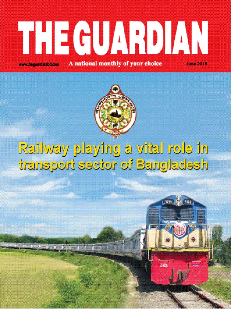


Survey of Bangladesh (SOB) the National mapping Organization (NMO) inherits analogue map makingtechnology from its ancestors. Since 1997, SOB switched over digital mapping system with a limited number of hardware and software. In last decade, we have driven our mapping production line with analytical and digital method. Gradually, SOB recognized that digital photogrammetric system is the key mapping system that can save expenditure, manpower and time and at the same time, can produce accurate maps for infrastructural development and strategic plan.
SOB now implementing a project titled “Improvement of Digital Mapping System of Survey of Bangladesh (IDMS)” to produce 1:25,000 scale digital topographical maps and GIS data covering whole country and 1:5000 scale topographic map for major cities by using ArcGIS.
First of all, new challenge we faced in cartographic is symbology. Symbology is the set of conventions, rules, or encoding systems that define how geographic features are represented with symbols on a map. A characteristic of a map feature may influence the size, color, and shape of the symbol used. According to the rule of topographical map symbology, we tried to create symbol specification. The size and shape that we have kept like our traditional map symbol because topographical map symbol bears the traditional and historical impression in one region of the map series. So, our understanding, a task in digital map symbology is about over print activities that should be apply for printing production line which we have little knowledge on that. During this process, we have come to know the overprint advantage and disadvantage.
ArcGIS allows us to create and edit several kinds of data. We can edit feature data stored in shape files and geo data bases, as well as various tabular formats. These include points, lines, polygons, text (annotations and dimensions), multi patches, and multi points. We can also edit shared edges and coincident geometry using topologies and geometric networks. Whether we are using ArcView, ArcEditor, or ArcInfo, we use the same editing tools in ArcMap to compile and update our topographical data.
Specific editing operations that may cause problems include changing the shapes of features, snapping to the edge or boundary of features, or extending and trimming features. These problems are more likely to occur when the features we edit are close to the edge or beyond the area of use of the coordinate system. It is important to understand that coordinate systems should be the same in an area of use. The area of use defines where it is appropriate to use a particular coordinate system. We need to ensure that our data is located within these limits. Again, problem occurs is due to the distortions that affect features covering a large geographic extent.
Symbols graphically describe, categorize, or rank geographic features. Labels and annotation in a map to locate and show qualitative and quantitative relationships. Symbols are four types—marker, line, fill, or text—depending on the type geometry they draw. They are generally applied to groups of features at the layer level, but graphics and text in a layout are also drawn using symbols.
The easiest way to apply symbols to features and graphics is to choose from one of the thousands stored in the styles provided with ArcGIS. We can search for appropriate symbols by name or a keyword or simply browse through a visual palette to find what we need. We can apply symbols directly as they are or modify them first. Modified symbols can be saved in a style for later reuse.
Symbols can be created and applied directly to features and graphics, and they can be optionally stored, managed, and shared in collections called styles. Styles are containers for reusable things that appear on maps, they are a place to store, organize, and share symbols and other map components. Styles can promote standardization across related map products or across organizations by ensuring consistency. So, symbol style is the important issue for production of mapping although we have our own symbol style fashion for topographical map in SOB.
Digital Map Generalization, a big challenge in Digital Cartography.
Following are the impediments in digital Cartography:
a. The extraction, reduction, and simplification of features for change of scale or resolution.
b. The process of reducing the number of points in a line without losing the line’s essential shape.
c. The process of enlarging and resampling cells in a raster format.
Following table shows the various feature characteristic in generalization:
|
Description |
|
| Aggregate Points | Creates polygon features around clusters of proximate point features. |
| Aggregate Polygons | Combines polygons within a specified distance to each other into new polygons. |
| Collapse Dual Lines to Centerline | Derives centerlines from dual-line (or double-line) features, such as road casings, based on specified width tolerances. |
| Merge Divided Roads | Generates single line road features in place of matched pairs of divided road lanes. |
| Simplify Building | Simplifies the boundary or footprint of building polygons while maintaining their essential shape and size. |
| Simplify Line | Simplifies lines by removing extraneous bends while preserving essential shape. |
| Simplify Polygon | Simplifies polygons by removing extraneous bends while preserving essential shape. |
| Smooth Line | Smooth’s sharp angles in lines to improve aesthetic or cartographic quality. |
| Smooth Polygon | Smooth’s sharp angles in polygon outlines to improve aesthetic or cartographic quality. |
| Simplified Road | Generates a simplified road network that retains connectivity and general character to display at a smaller scale. |
The final stage of map production is the printing in Offset Press. Digital graphic formats like pdf, tiff or eps file formats data are processed to the Flasher /Image Setter to produce CMYK (Cyan, Magenta, Yellow, Black) originals on to the film and these film positives are used for making plate.
If 4-color printing press is used, it can print a map containing all colors at one go. But the challenge is for printing multicolor tiny symbol like `Hut.` Because if the red hut symbol create by two color i.e.80% Magenta and 20% Yellow, the machine will print from two different plate and if the adjustment of plate is not registered exactly, in that case two different color will not match or superimposed properly, the `Hut` symbol will show hazy or out of focus and the map printing quality become low and stumpy. So, creation of minute or thin line symbol color should be mono color. On the other hand use of `Spot color` in printing process could solve the problem.
GIS data and Cartographic data have different use of their own platform. To a beginner, the understanding between GIS and Cartography data seems little bit same, but the data are completely different. GIS data has enormousinformation like it has attribute, value, metadata, tabular data topology, and so on. On the other hand, Cartographic data has symbolic identity in each individual feature. Cartographic expression always bears a graphic impression either it is vector or raster format. Different color, texture, value, shape may use as cartography data. GIS textual coded data is relate with cartographic same coded symbol data. According to attribute of GIS data, Cartography systems visualize the same data with logical symbol on map. This task is yet a challenge to the digital map production system in SOB.